1997-2000
THIRD VIEW
Third View added a third image to the pairs made during the Rephotographic Survey Project. It began exactly twenty years after the first rephotography project and used the same methods to repeat photographs made for the western surveys of the 1860s and 1870s. Photographs for this project continued to be made on film, but otherwise Third View differed from the RSP in the extended use of new technologies.
Like the Rephotographic Survey Project, Third View was a collaboration, but unlike the Rephotographic Survey Project the team for this project traveled and worked together in the field throughout the project's duration. The participants were graduate students in the photo program at Arizona State University including Byron Wolfe, Kyle Bajakian, Toshi Ueshina, and Michael Marshall. In the second year, the writer William L. (Bill) Fox joined the team and wrote the field notes that were published on the DVD.
The fieldwork took the team to more than 110 sites in Arizona, Utah, Nevada, Colorado, and Idaho. Fieldwork was intentionally experimental.
One incident in 1998 entailed an early attempt to create a bloglike website based on a field-trip journey through Nevada. The team had mixed results in uploading text and photographs made with an early 1.5 megapixel digital camera (my first) via dial-up modems in motel rooms. We carried a carload of tower computers and cathode ray tube monitors into the field as an experiment and discovered that blogging technology at that time was a little premature for our aspirations.
For me the project began as a way to reconnect to my roots in landscape photography and test my understanding of the relationship between time and change. I could not have predicted the course the project eventually took toward its electronic completion, largely due to the intense and fluid work of the collaboration. It did help cement a longer-term working relationship with Byron Wolfe, the designer and programmer of the project's DVD. Byron and I worked closely together on the disk for several years while preparing the project for publication, and the positive outcomes of that relationship led to more collaborations in projects that followed.

A screenshot of the interactive map from the "Journey" page of the Third View project interactive DVD. Rolling a computer mouse over the map locations highlights active areas of the disk. Double clicking the mouse takes the viewer to those sites and other content.

A screenshot showing the "Teapot Rock Walk-Around," from the Third View project interactive DVD. The right-hand side of the screen shows a stylized map of two rock formations at Green River, Wyoming: Teapot Rock and the Sugar Bowl. The line in orange shows a walking path used to connect five different nineteenth-century photographs, four by Timothy O'Sullivan and one by William Henry Jackson. On the left side of the screen the images made along the path at regular intervals are displayed in an animation of the walk via clicking the computer mouse on the path. The animation stops at the vantage points of the historic photographs, which are embedded into the pathway photos.

A screenshot of the scrolling panorama made at William Bell's "Perched Rock, Rocker Creek, Arizona," from the Third View project interactive DVD. The project made 360 degree panoramas from the camera positions used by the nineteenth-century photographers. The original images were then embedded into each panorama and viewers could scroll through the scene showing what was behind the camera, or click a button to turn, make the earlier view disappear, or reappear.

A screenshot from the Third View project interactive DVD showing Timothy O'Sullivan's photograph of "Green River Buttes, Green River, Wyoming, 1872," including the "Time Reveal" window showing Castle Rock in 1997. By clicking the computer mouse on the window icon, a smaller rectangle appears over the image showing that part of the same scene, but at a different time. The viewer can move the window to examine different parts of the image, and also change the time shown in both the window and the background image.

Mark Klett, Viewing Thomas Moran at the Source, Artist's Point, Yellowstone National Park, 8/3/00
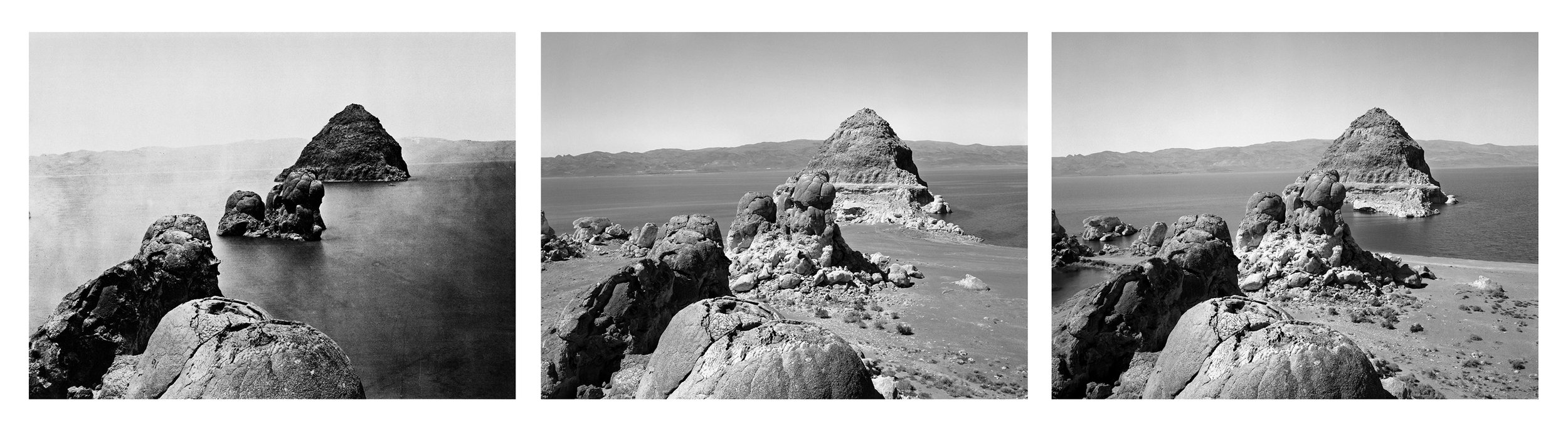
Byron Wolfe and Mark Klett for the Third View Project, Panorama from O’Sullivan’s “Pyramid Lake” camera position, 2000.
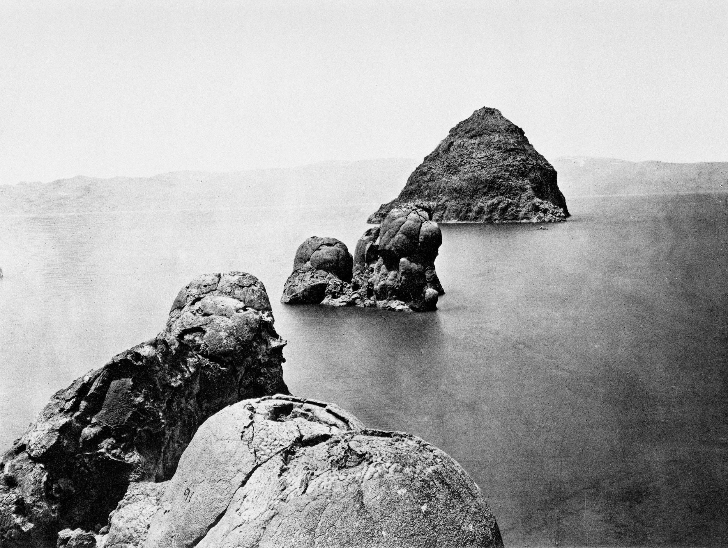
Inset: Timothy O’Sullivan, Rock formations, Pyramid Lake, Nev. 1867

Timothy O'Sullivan, Rock formations, Pyramid Lake, NV, 1867
Mark Klett for the Rephotographic Survey Project, Pyramid Isle, Pyramid Lake, NV, 1979
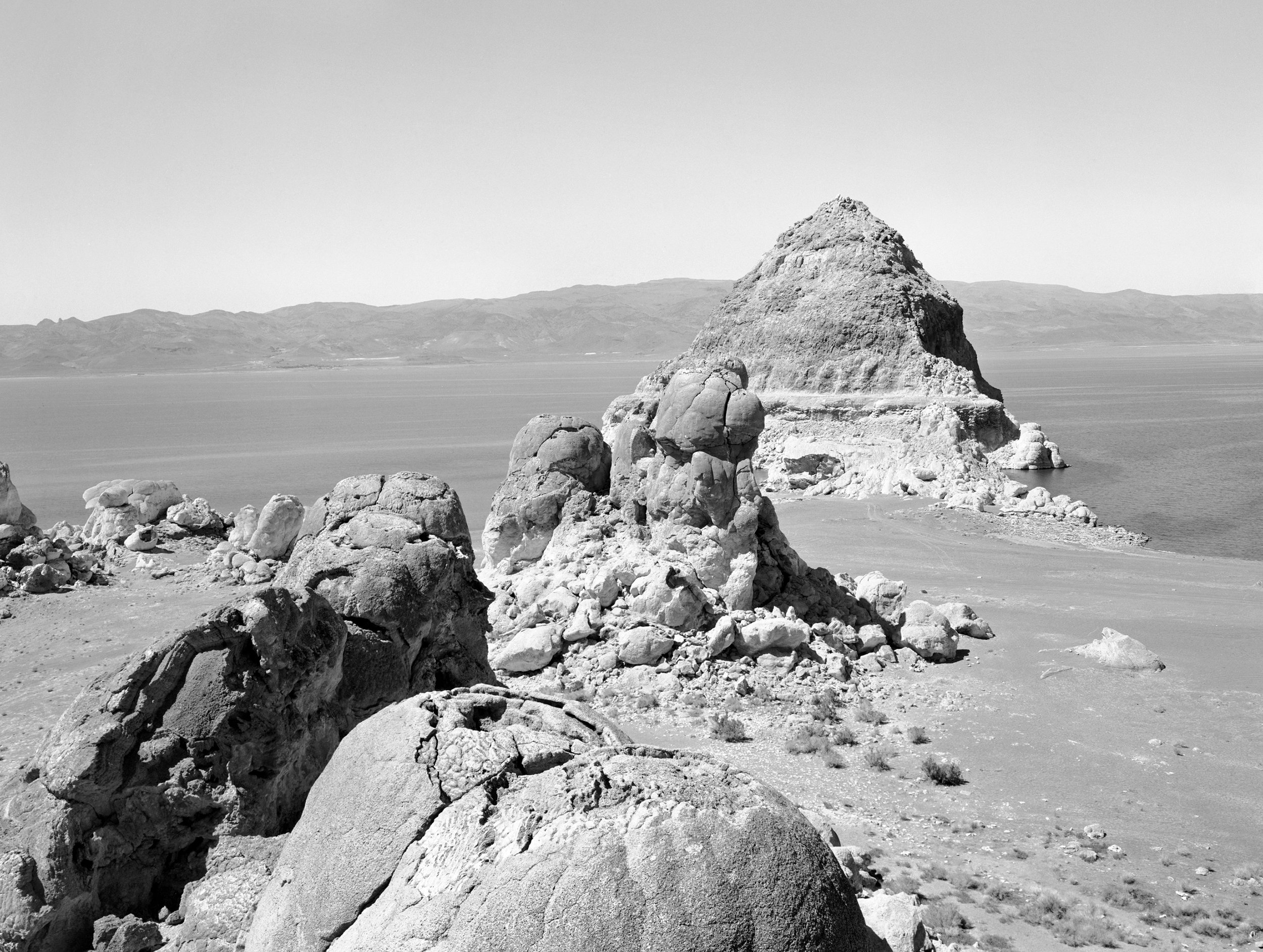
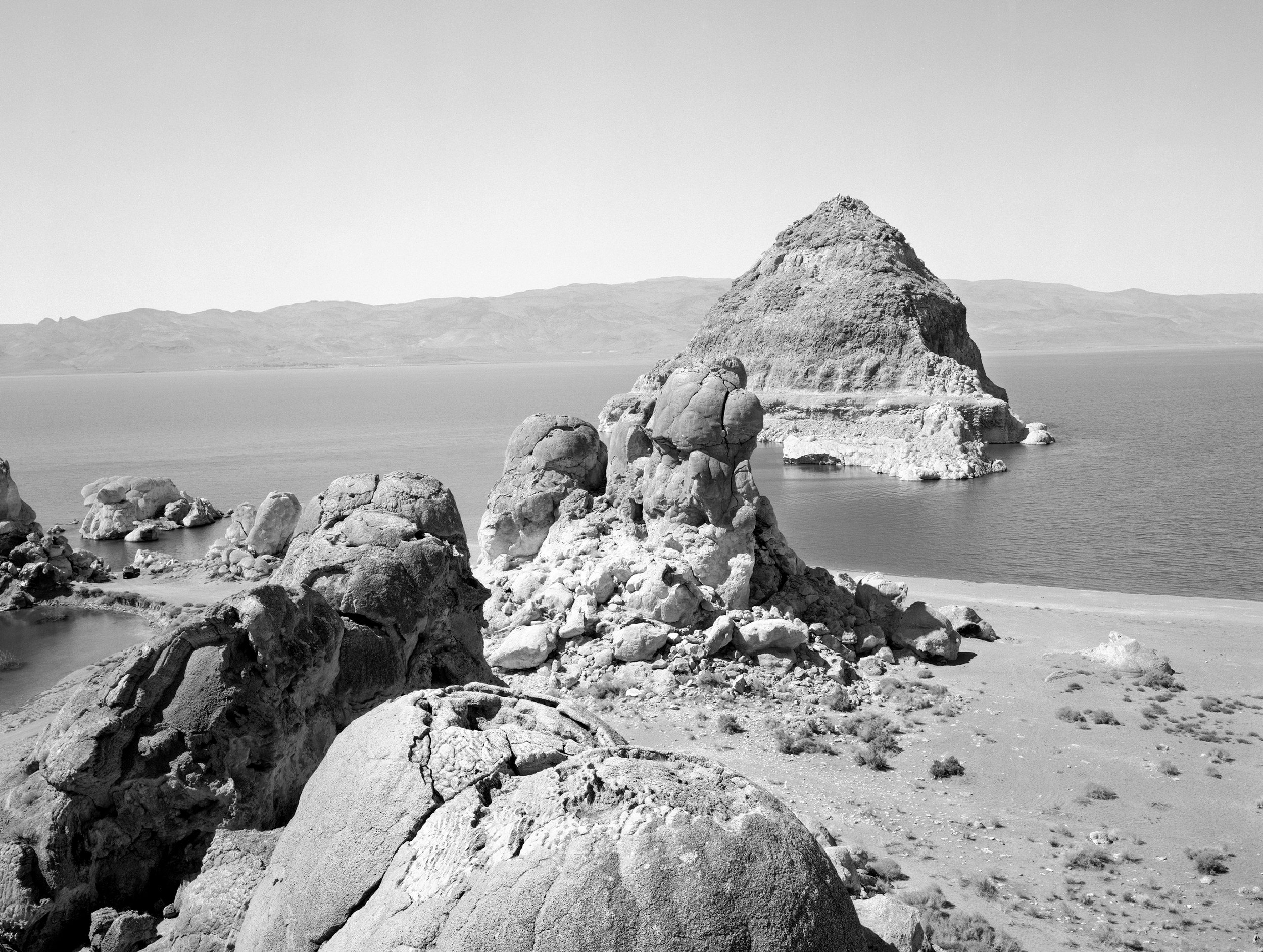
Mark Klett and Byron Wolfe for the Third View Project, Pyramid Island from the tufa knobs, Pyramid Lake, NV, 2000

Timothy O'Sullivan, Shoshone Falls, ID, ca. 1868
Mark Klett and Byron Wolfe for the Third View Project, Shoshone Falls from park grounds (obscured by trees), Twin Falls, ID, 1999

Byron Wolfe and Mark Klett for the the Third View Project, Panorama from O’Sullivan’s “Shoshone Falls.” 1999.
Inset: Timothy O’Sullivan, Shoshone Falls, Idaho, ca. 1868.

Mark Klett, Rebecca cooking coq au vin near the side of Robert Smithson's Spiral Jetty, Salt Lake, 7/29/00
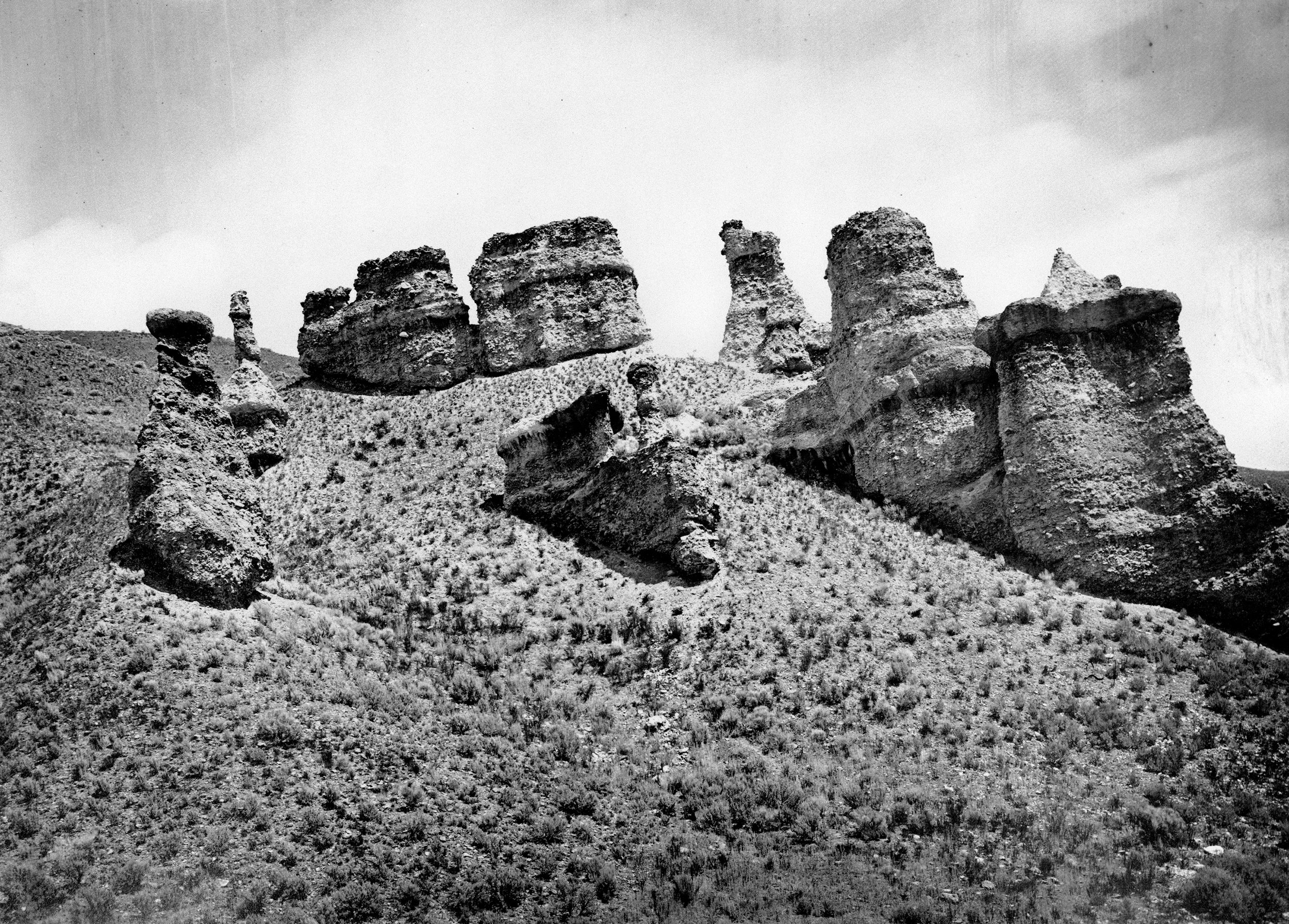
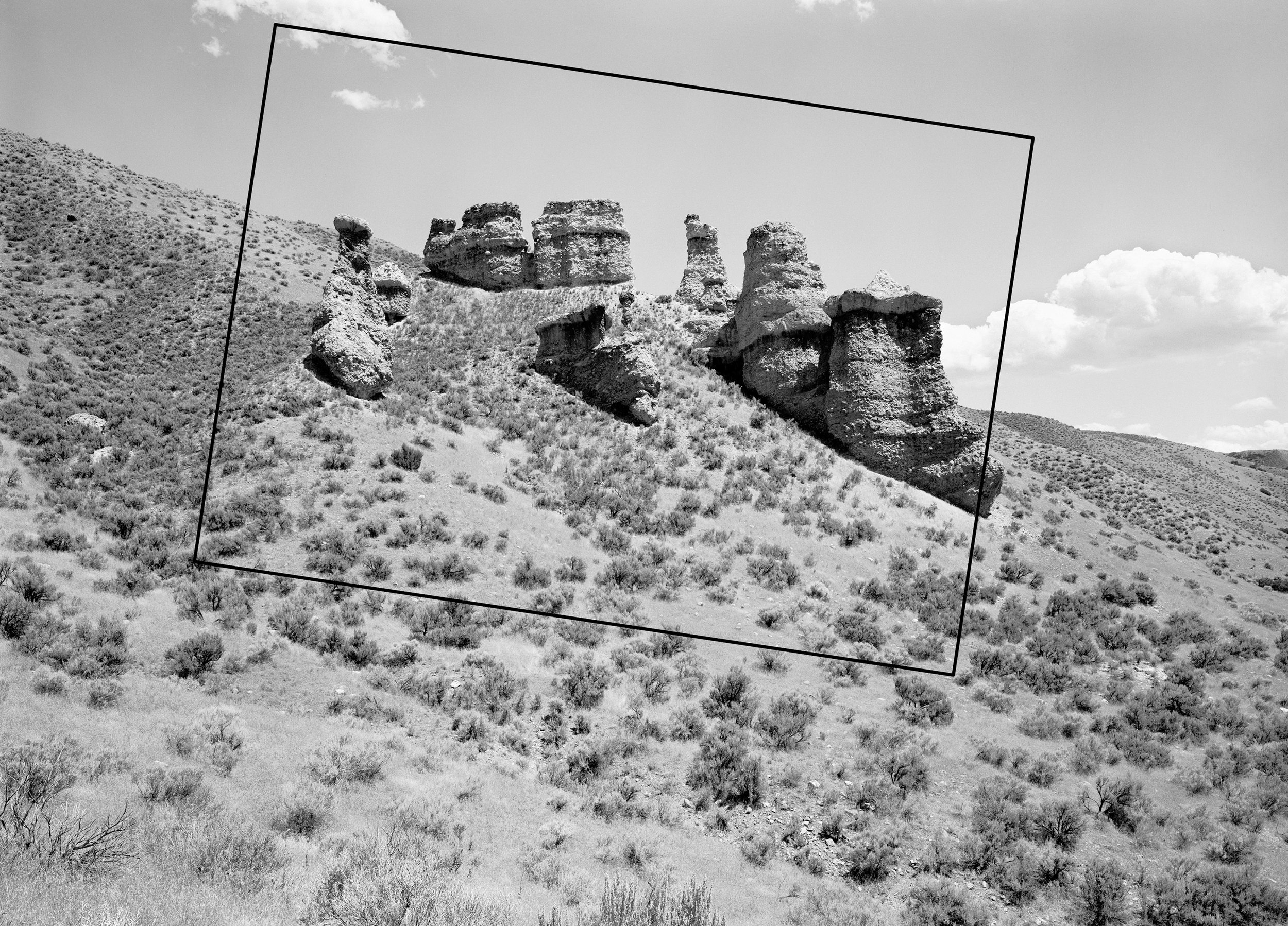
Timothy O'Sullivan, Tertiary Conglomerates, Weber Valley, UT, 1869
Rick Dingus for the Rephotographic Survey Project, Witches Rocks, Weber Valley, UT, 1978
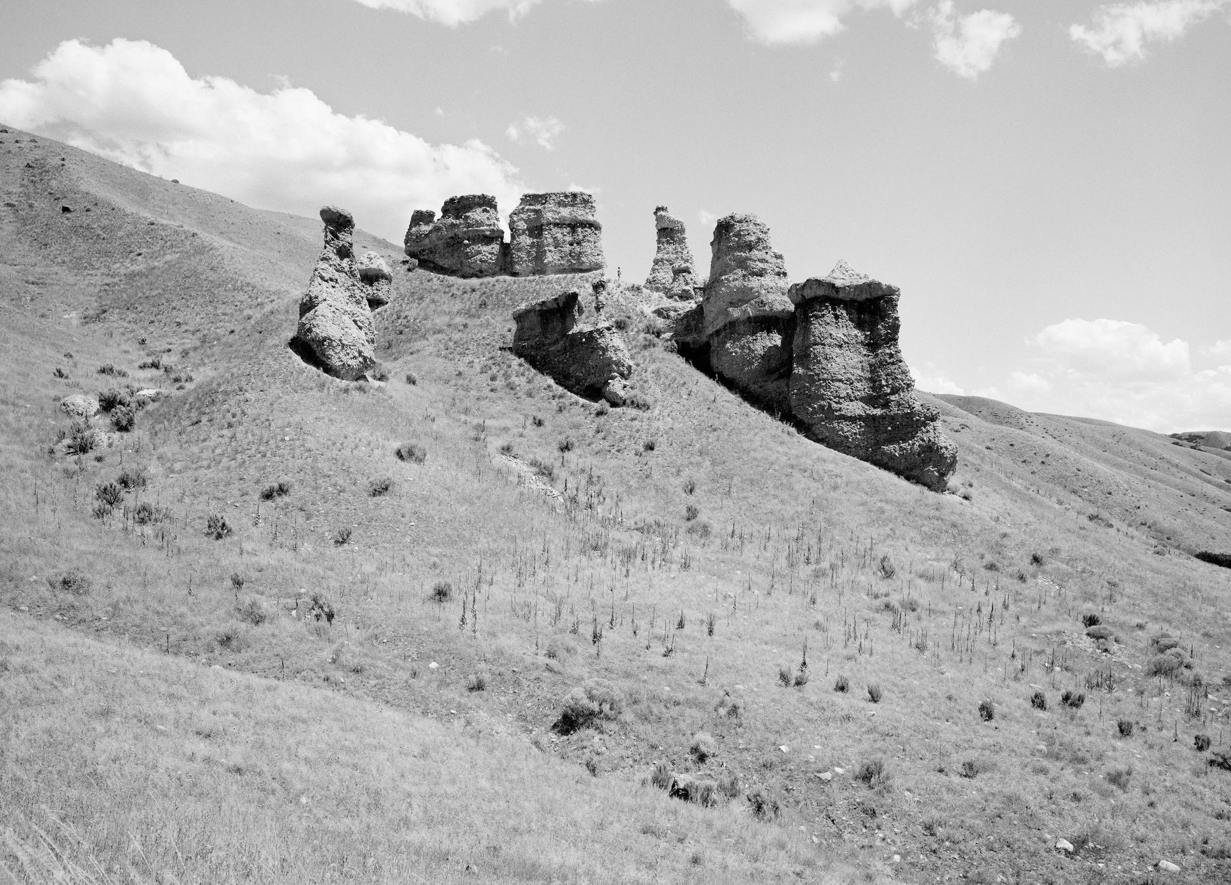
Mark Klett for the Third View Project, Witches Rocks, Weber Valley, UT, 1997

Timothy O'Sullivan, Untitled, 1889.
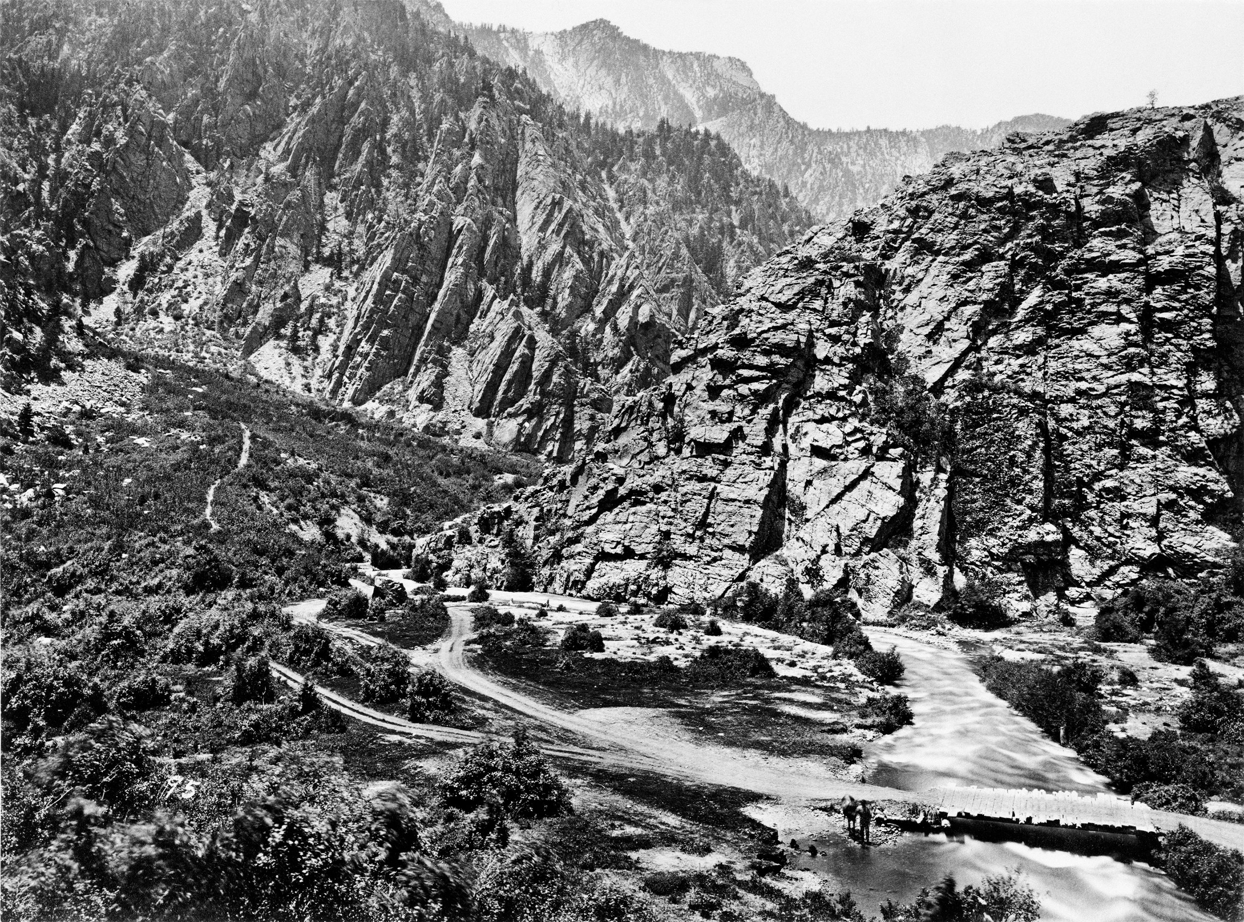
Rick Dingus for the Rephotographic Survey Project, Edge of Storm Mountain Reservoir, Big Cottonwood Canyon, UT, 1978
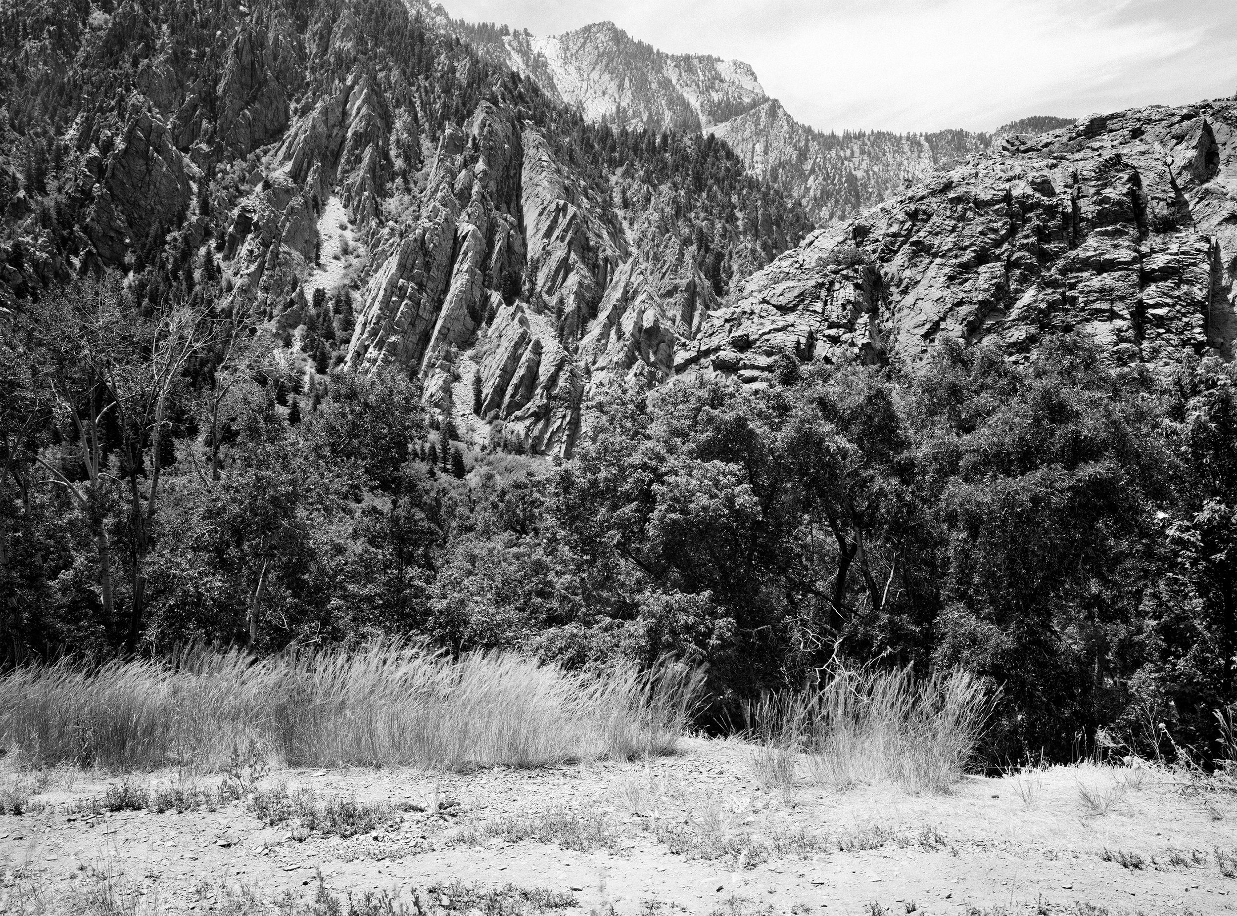
Mark Klett and Byron Wolfe for the Third View Project, Edge of Storm Mountain Reservoir, Big Cottonwood Canyon, UT, 1999

Timothy O'Sullivan, Water rhyolites near Logan Springs, NV, 1871

Mark Klett and Byron Wolfe for the Third View Project, Water rhyolites near Hiko, NV, 1998
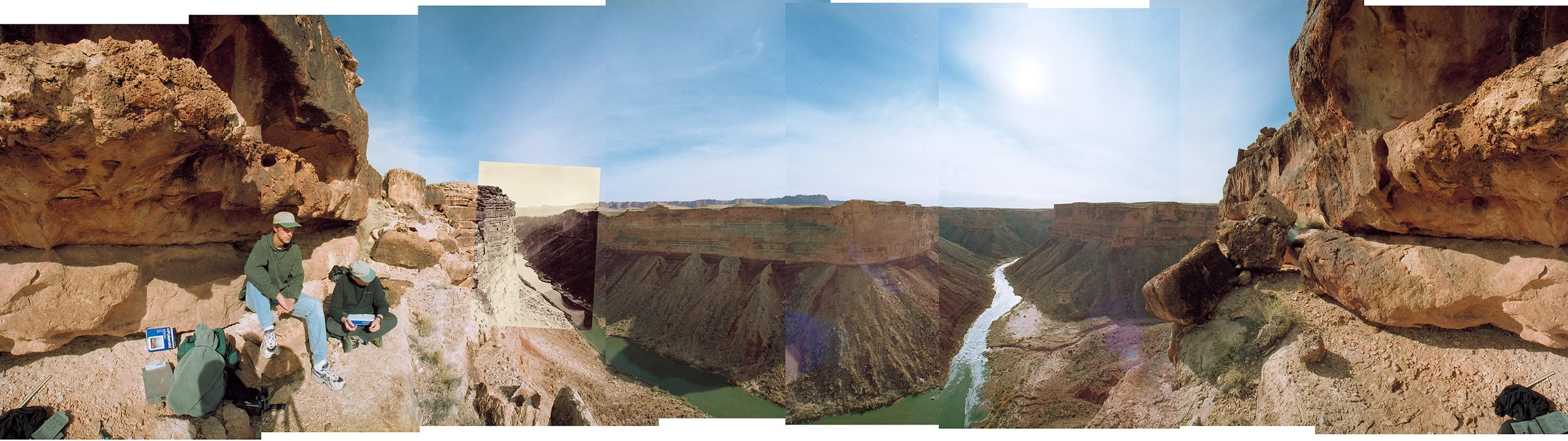
Mark Klett and Mike Marshall, Panorama from William Bell's vantage point for Grand Cañon, Colorado River, Near Paria Creek, Looking East, 2000
Inset: William H. Bell, Grand Cañon, Colorado River, Near Paria Creek, Looking East, 1872

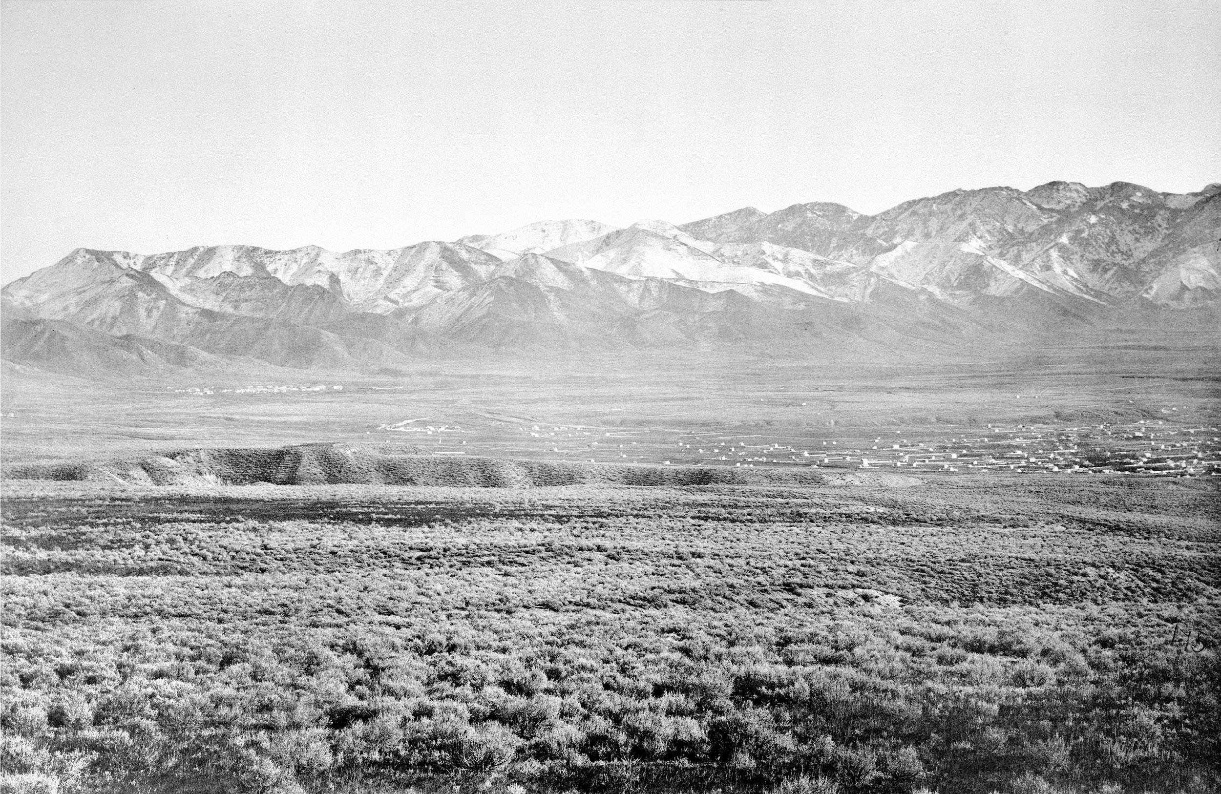
Timothy O'Sullivan, Mountains, Salt Lake City, UT, Camp Douglas and east end of Salt Lake City, Emigration Cañon on left, 1869
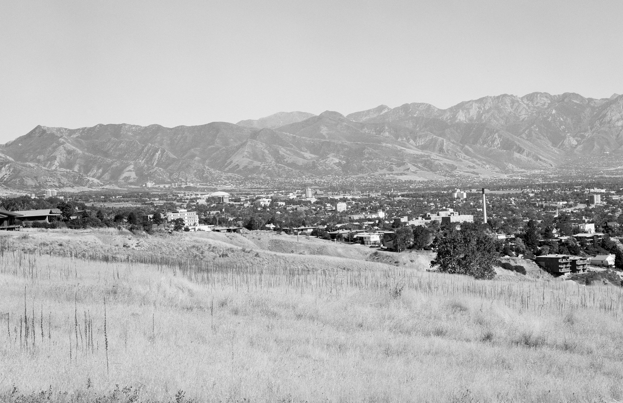
Gordon Bushaw for the Rephotographic Survey Project, Salt Lake City, UT, 1978 (left half)
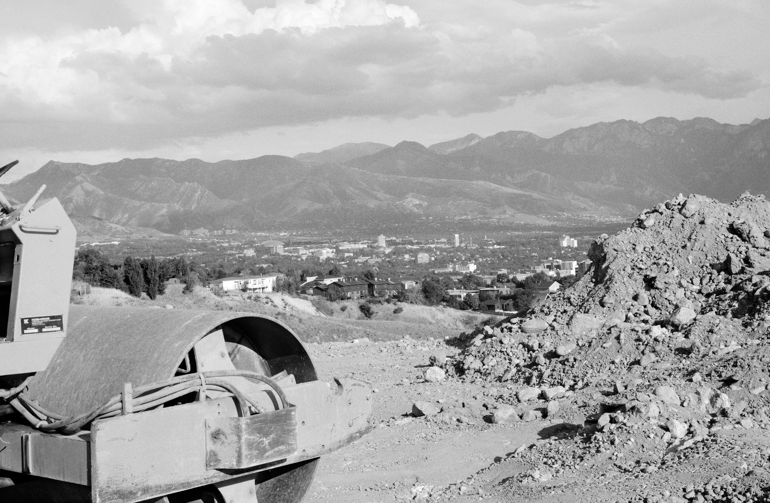
Mark Klett and Toshi Ueshina for the Third View Project, New housing development, "Dorchester Pointe," Salt Lake City, UT, 1997

Mark Klett and Toshi Ueshina for the Third View Project, Panorama from O’Sullivan’s camera position at Salt Lake City, becoming a gated community, 1997.
Inset: Timothy O’Sullivan, Wahstach Mts., Salt Lake City, Utah, Camp Douglas and east end of Salt Lake City, Emigration Cañon on left, 1869.

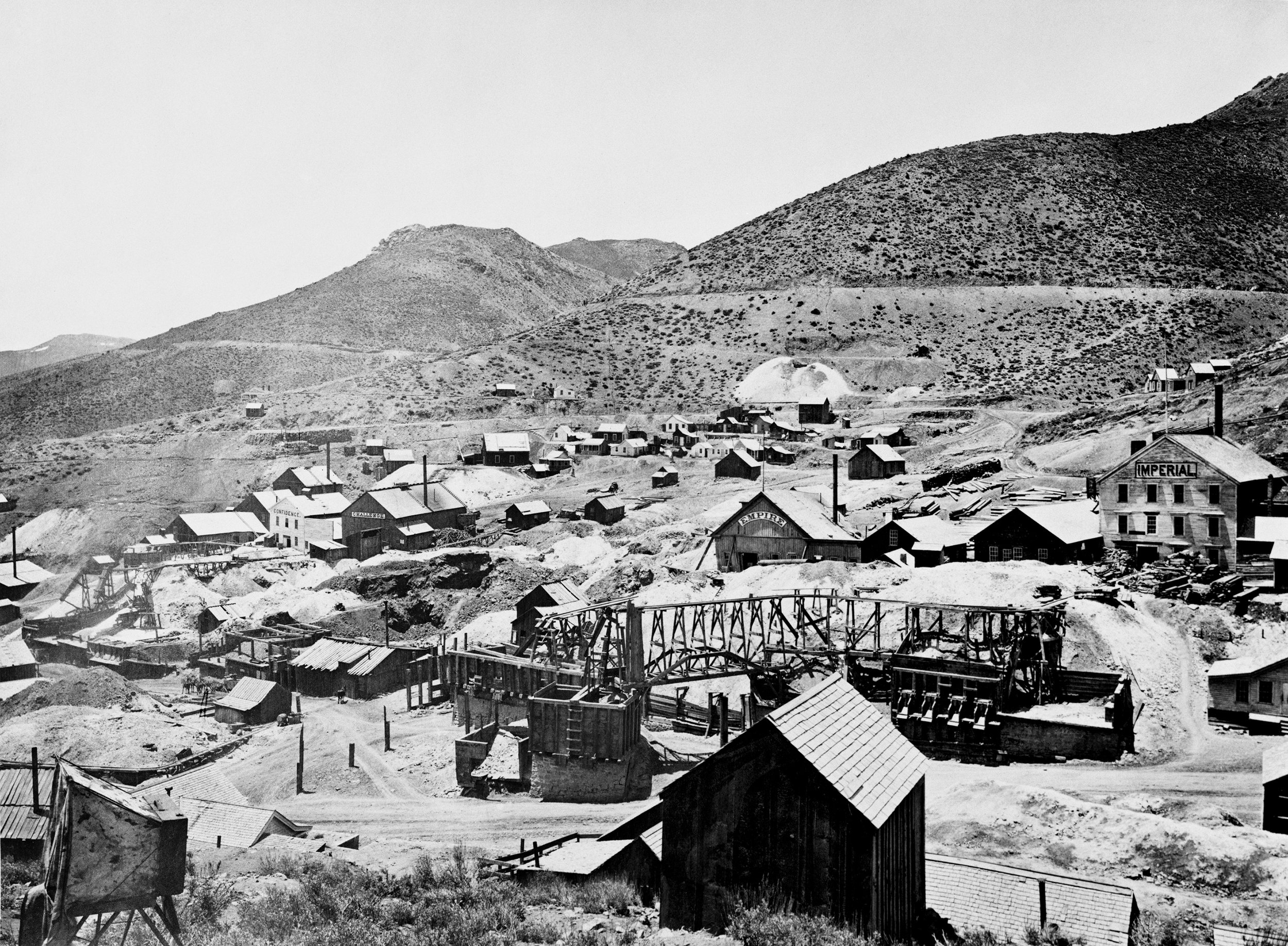
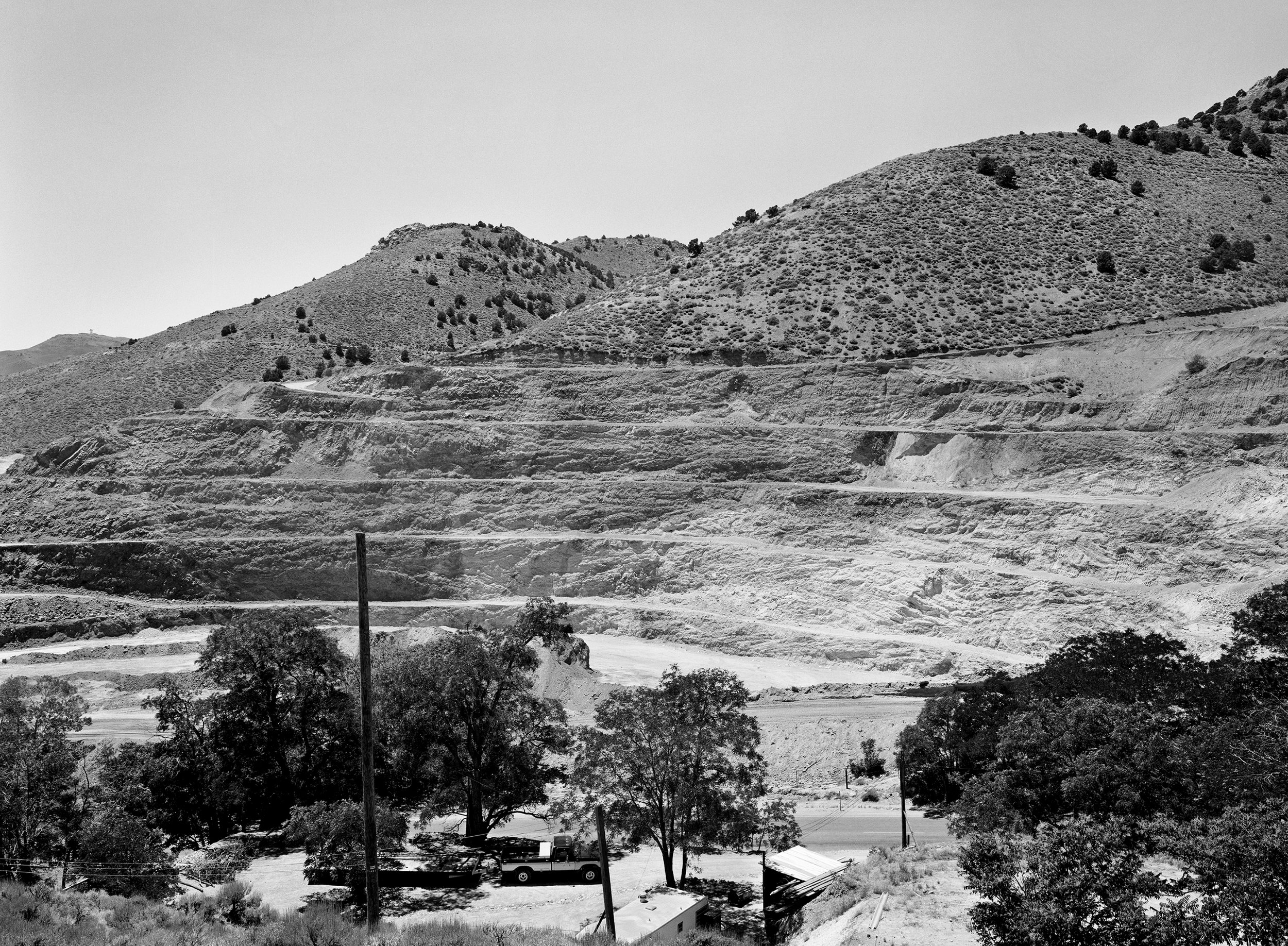
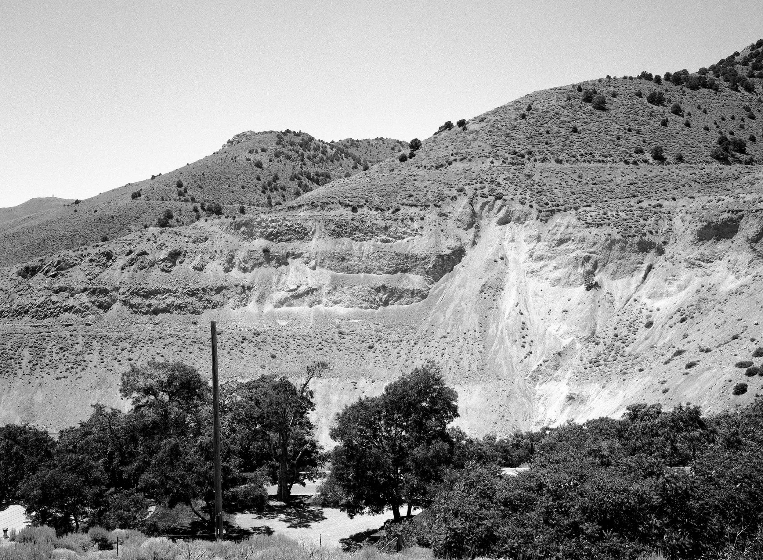
Timothy O’Sullivan, Comstock Mines, 1868
Mark Klett for the Rephotographic Survey Project, Strip mine at the site of Comstock Mines, Virginia City, NV, 1979
Mark Klett and Byron Wolfe for the Third View Project, Abandoned strip mine at the site of Comstock Mines, Virginia City, NV, 1998

Mark recording data at O’Sullivan’s vantage point above the Green River, now reservoir, Wyoming 1998
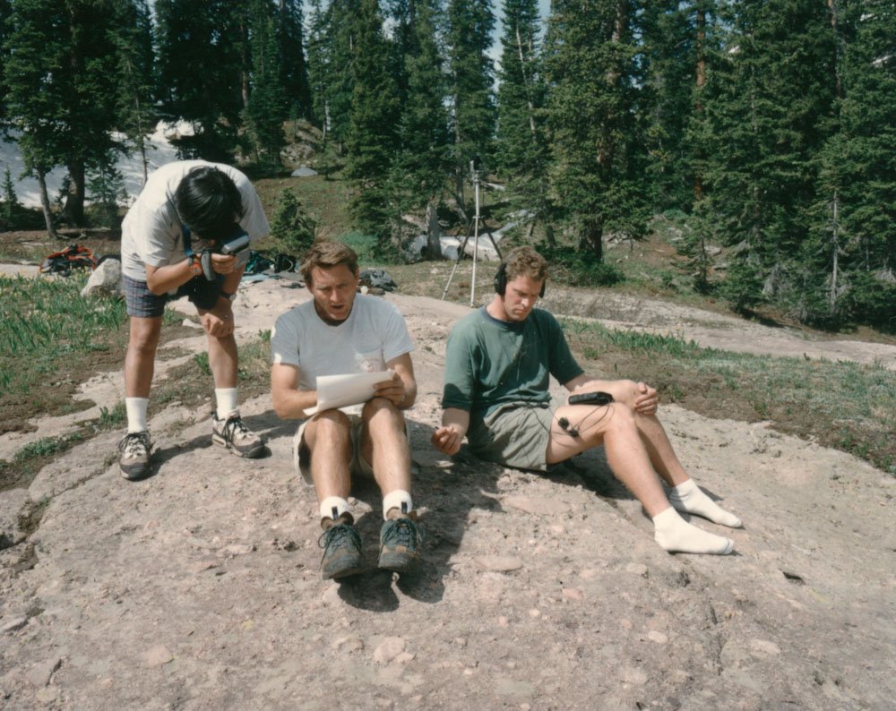
Toshi videotaping, Mark taking notes, Byron recording sound at Geneva Lake, Colorado 1997
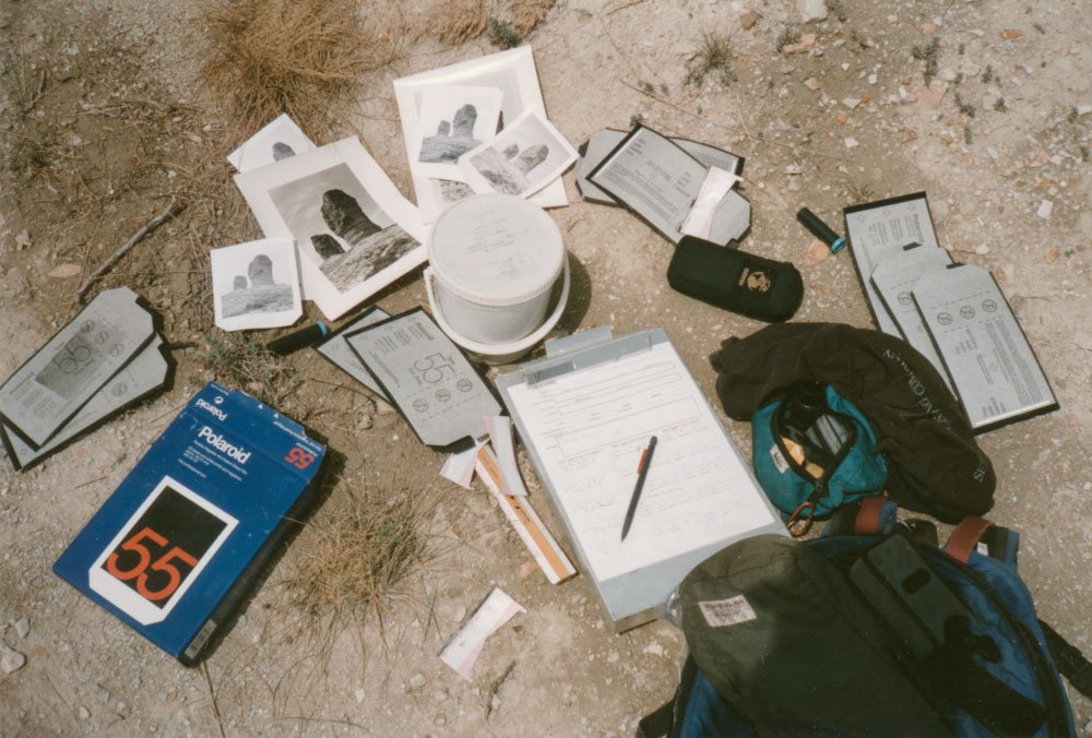
Polaroid film and bucket for clearing negatives, Green River, Wyoming 1997
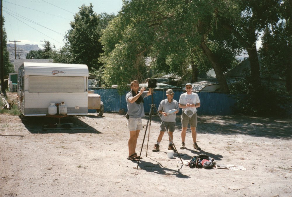
Mark, Toshi, Byron on site, Green River, Wyoming 1997
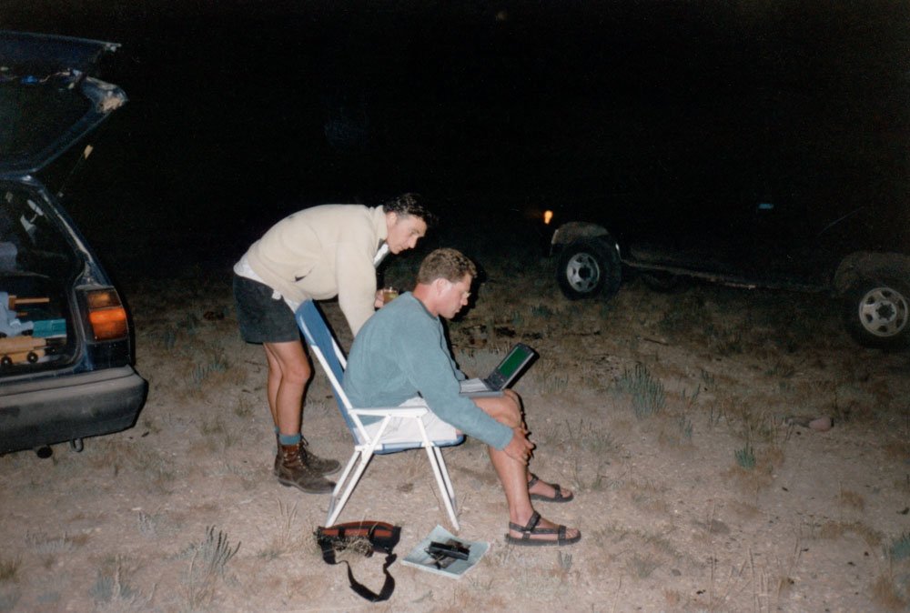
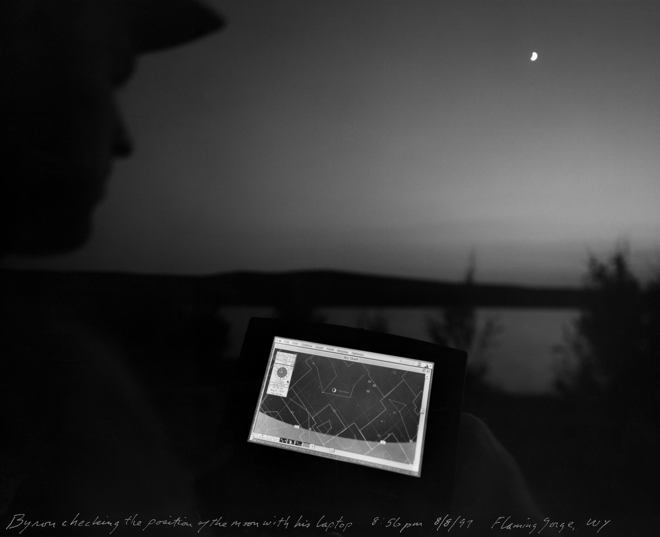
Kyle and Byron checking images on laptop, Wyoming 1997
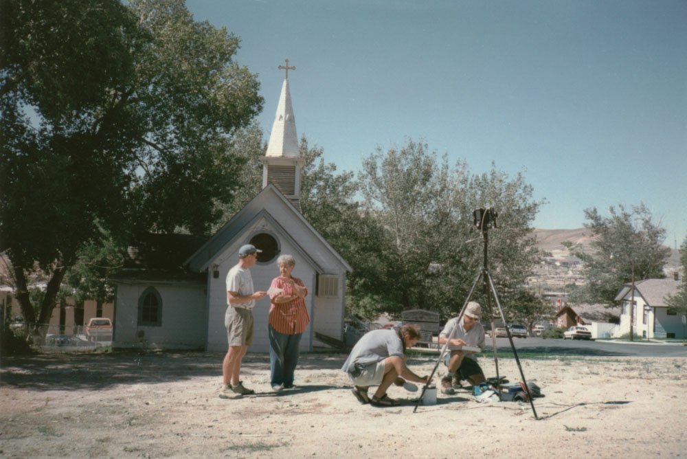
Byron talking to homeowner, Mark and Toshi on site in Green River, Wyoming 1997
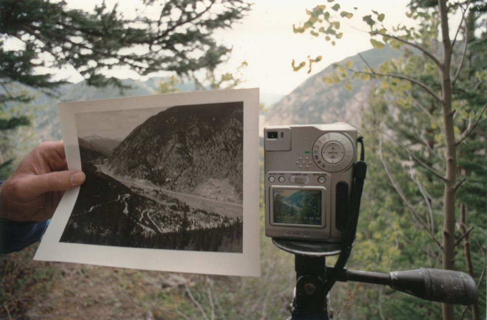
First digital camera, 1.5 megapixel, comparing digital image to copy print, Georgetown Colorado 1998
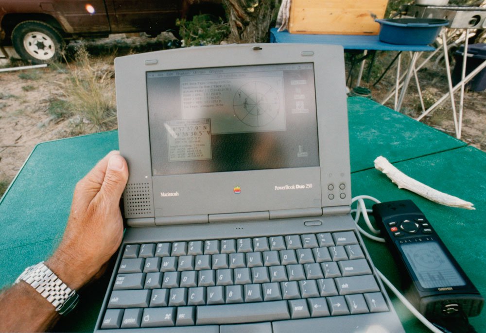
Byron’s MacIntosh PowerBook Duo and GPS unit, Wyoming 1997
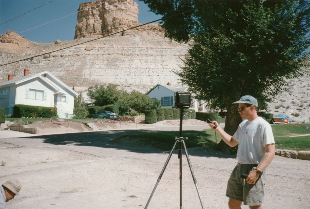
Byron on site at Green River, Wyoming 1997
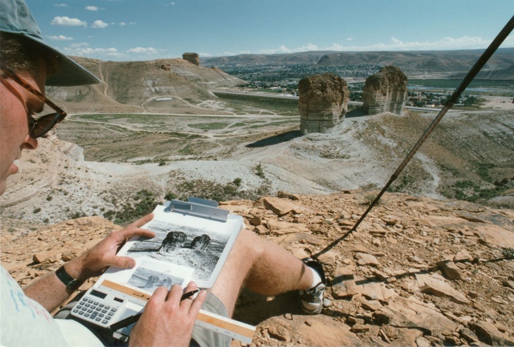
Byron checking the measurements for repeating O’Sullivan’s view of “Teapot Rock and the Sugar bowl” Green River, Wyoming 1998
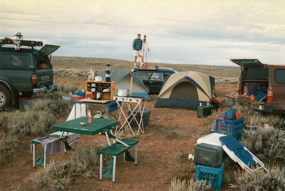
Byron surveying camp above Green River, Wyoming 1998
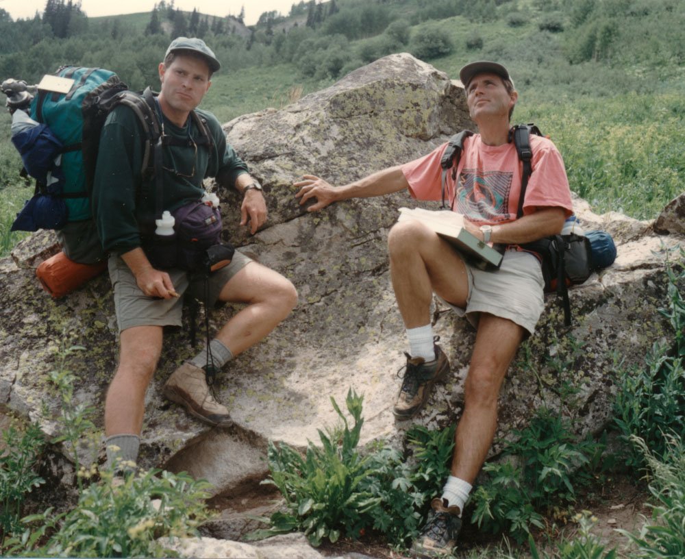
Byron and Mark resting on the hike to Geneva Lake, Colorado 1997

Selected Third View Panoramas

Mark Klett and Mike Marshall for the Third View Project, Balanced Rock off Route 89A near Vermillion Cliffs, AZ, 2000.
Inset: Willliam Bell, Perched Rock (Rocker Creek). ca. 1872.

Byron Wolfe and Mark Klett for the Third View Project, Panorama from O’Sullivan’s “Entrance of Canyon of Lodore”, 2000.
Inset:Timothy O’Sullivan, 1872. Brown’s Park from Entrance of Canyon of Lodore, southern Wyoming.
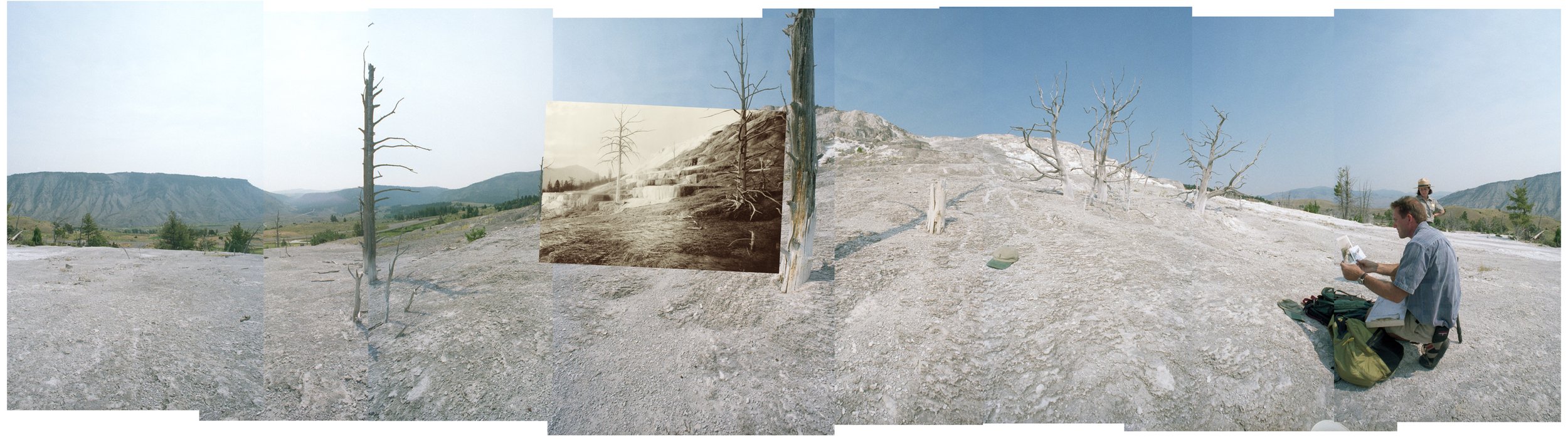
Byron Wolfe and Mark Klett for the Third View Project, Panorama near Jackson’s “Pulpit Terraces” camera position, 2000.
Inset: William Henry Jackson, Pulpit Terraces,
Mammoth Hot Springs, ca.1883.
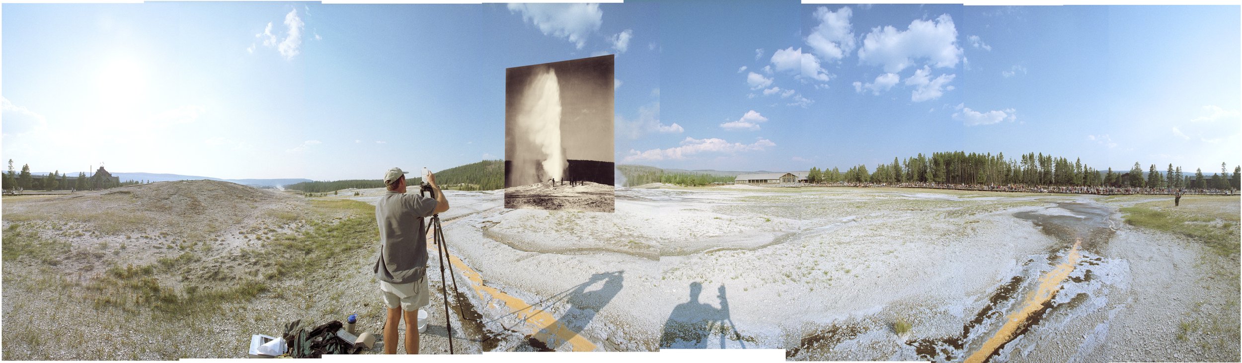
Byron Wolfe and Mark Klett for the Third View Project, Panorama showing W.H. Jackson’s “Old Faithful” camera position, 2000.
Inset: William Henry Jackson, Old Faithful in eruption, 1878,
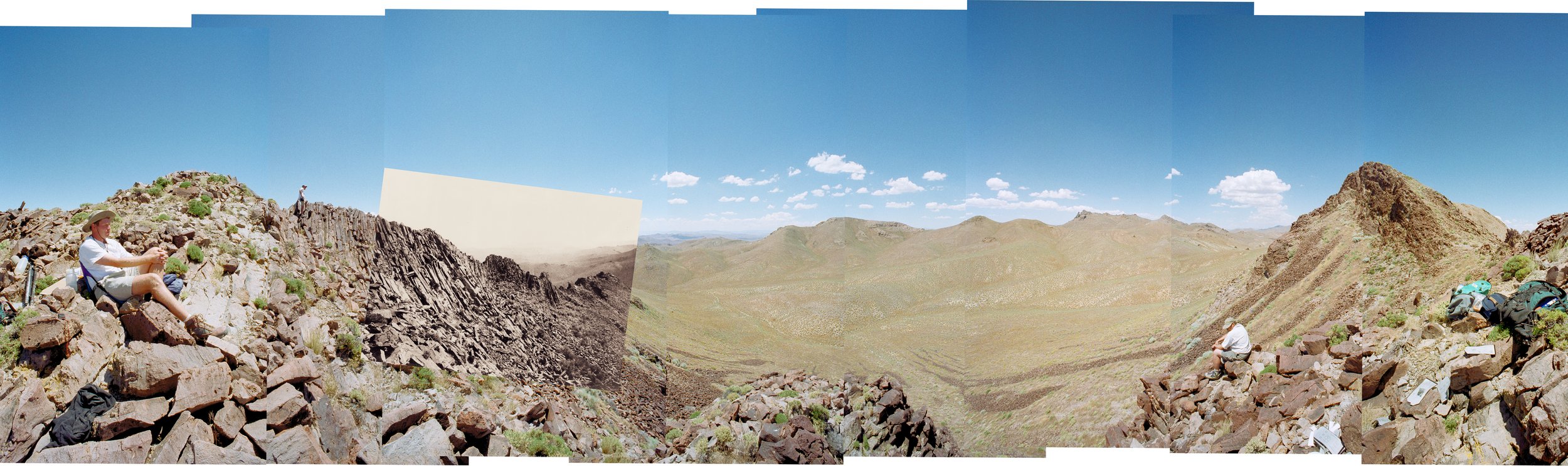
Byron Wolfe and Mark Klett for the Third View Project, From the top of “Karnak Ridge,” a columnar volcanic outcrop in central Nevada, 1998.
Inset: Timothy O’Sullivan, Crab’s Claw Peak, western Nev., 1867.

Byron Wolfe and Mark Klett for the Third View Project, Panorama from O’Sullivan’s “Entrance of Canyon of Lodore”, 2000.
Inset: Timothy O’Sullivan, Brown’s Park from Entrance of Canyon of Lodore, southern Wyoming,1872.

Byron Wolfe for the Third View Project, Mark’s truck stuck in the mud while searching for Thomas Moran’s “The Bluffs of Green River”, 1997.
Inset: Thomas Moran, The Bluffs of Green River, 1881. Illustration used on a Green River promotional brochure.
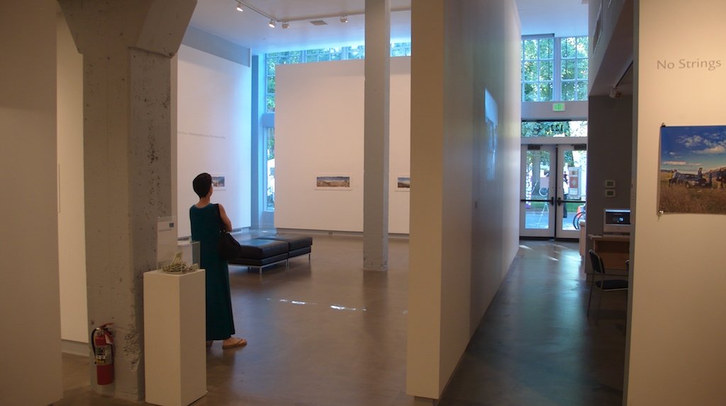
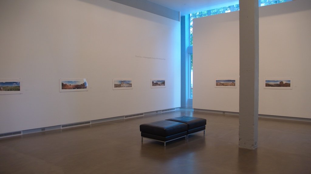
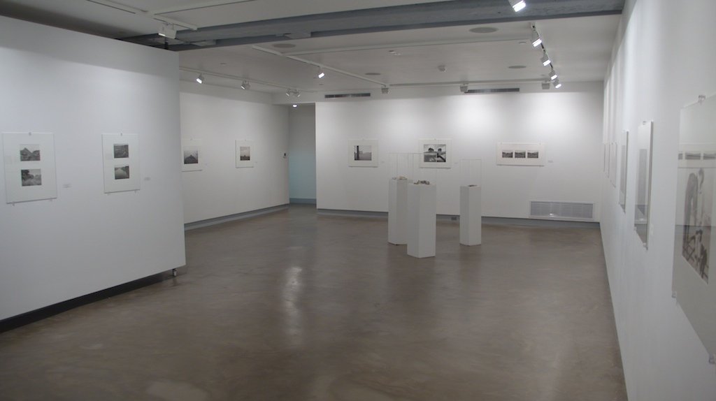
On Exhibition
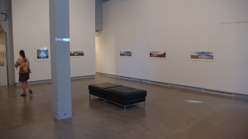
Third View

Third View, Light Factory, Charlotte, North Carolina, 2005
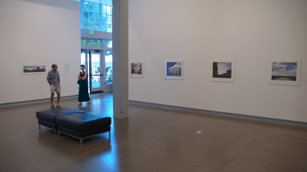
Third View, Blue Sky Gallery, Portland, Oregon, 2007
Third View, Blue Sky Gallery, Portland, Oregon, 2007
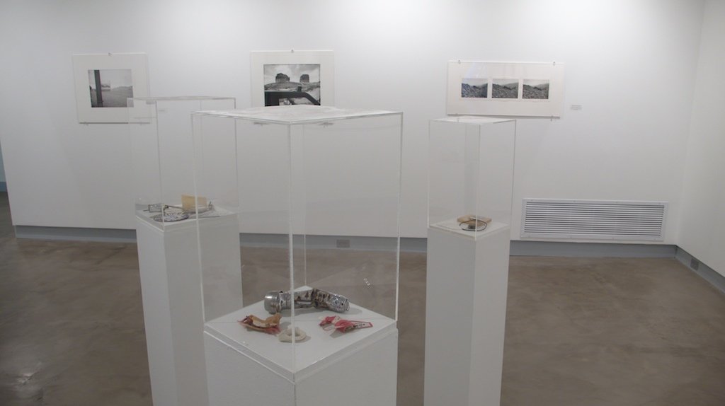
Third View, Blue Sky Gallery, Portland, Oregon, 2007
Third View, Blue Sky Gallery, Portland, Oregon, 2007
Third View, Blue Sky Gallery, Portland, Oregon, 2007
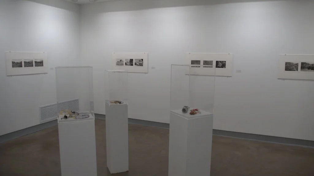
Third View, Blue Sky Gallery, Portland, Oregon, 2007
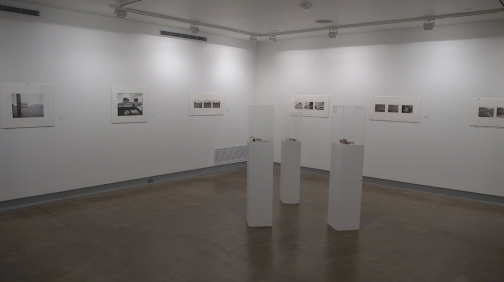
Third View, Blue Sky Gallery, Portland, Oregon, 2007
Third View, Blue Sky Gallery, Portland, Oregon, 2007
Related:
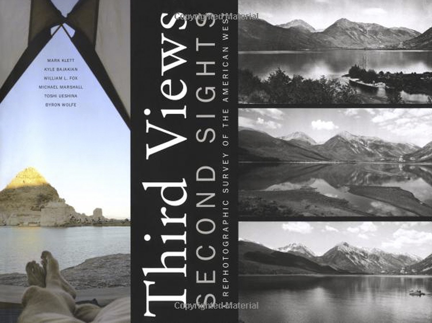
Third Views, Second Sights, A Rephotographic Survey of the American West
Museum of New Mexico Press, Santa Fe, 2004

Second View: The Rephotographic Survey Project, with Ellen Manchester and JoAnn Verburg
University of New Mexico Press, 1984

Seeing Time: Forty Years of Photographs
University of Texas Press, 2020