1977-1979
The Rephotographic
Survey Project
The word "rephotographic" doesn't exist in the English dictionary, but it was the word chosen to represent the spirit of the project Ellen Manchester and JoAnn Verburg and I created in 1977. The Rephotographic Survey Project (RSP) started as an idea, to track down the locations of historical nineteenth-century photographs of the American West made for government sponsored surveys in the 1860s and 70s and to duplicate those images by making new photographs from the same locations.
Previous to our project, "repeat photographs" were made by scientists to compare changes over time to the subjects of earlier photographs. The methods geologists used to accurately find the exact locations of landscape photographs formed the basis for our work, and we attempted to extend thier methods both technically and conceptually. In the RSP, "rephotography" meant accurately repeating an original photograph’s camera position, its visual composition, framing, time of year, and time of day while also acknowledging the participation of the photographer in making choices that influence the ways photographs may be interpreted. The RSP tried to duplicate the physical characteristics of the original photograph while also acknowledging the complex circumstances that photographs are made and viewed under.
The project was based on curiosity about how lands have changed over a hundred years of human intervention, what could be learned about how historical photographers worked and made their images, and with an interest in conceptual art practices. Urban growth, mining sites, and water impoundments formed the most profound physical changes to the lands we rephotographed. By contrast, in remote locations we sometimes found very little had changed. We learned that historical photographers had specific points of view, and we could sometimes predict where they would set up their cameras to make their photographs.
The project had three field seasons and photographers Gordon Bushaw and Rick Dingus contributed to the project during the second and third years. Altogether, 122 sites were rephotographed in Colorado, Utah, Nevada, California, Idaho, Arizona, and New Mexico. The RSP’s work was typically shown in diptych format, with the historic photograph reproduced on the left, and the rephotograph on the right. The project’s book, Second View: The Rephotographic Survey Project, was published in 1984.
In 1997, the Third View Project revisited many of the RSP the sites and used new technologies to explore rephotographic methods and ways to visualize rephotographs.
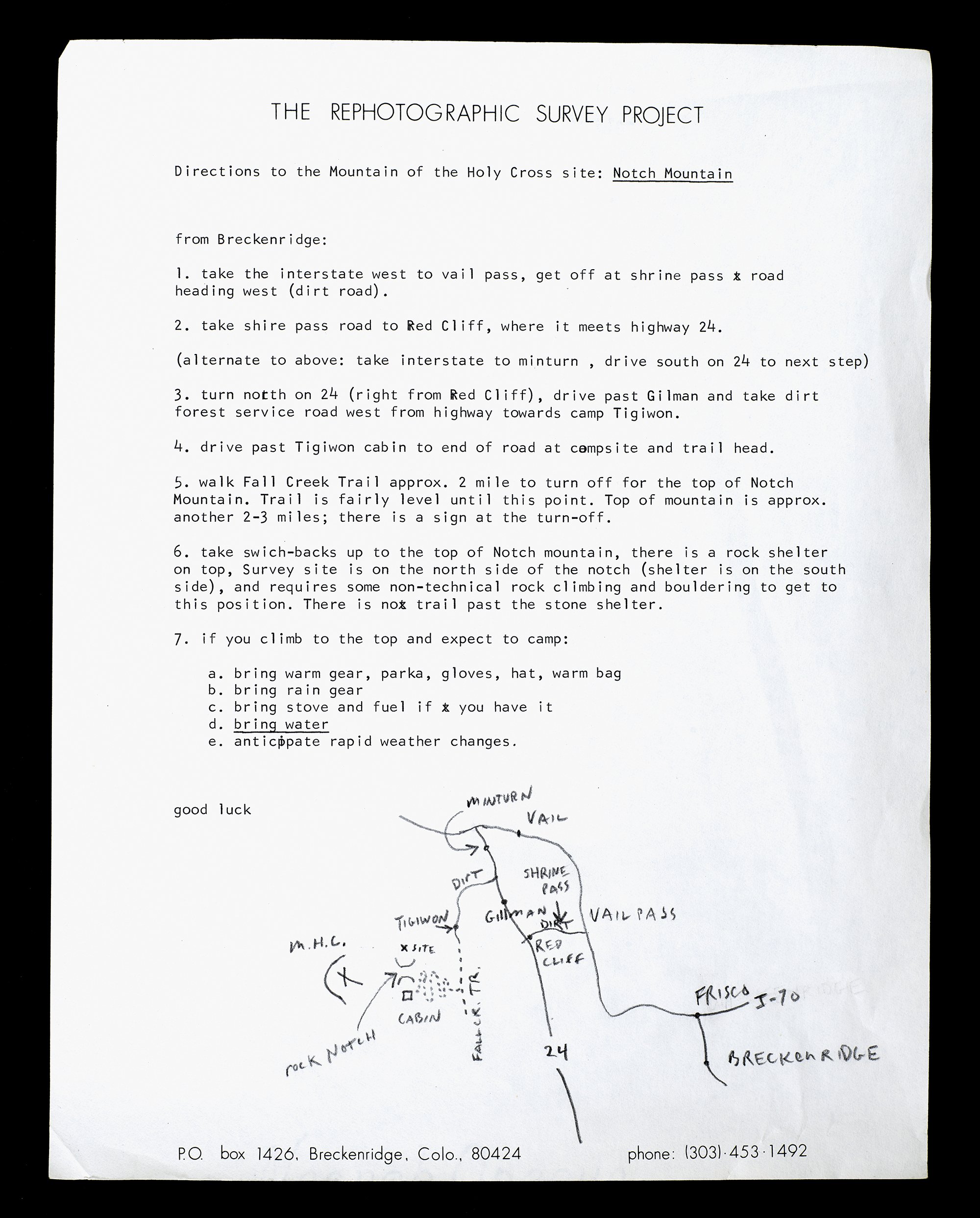
Directions to the Mountain of the Holy Cross, Colorado, 1977
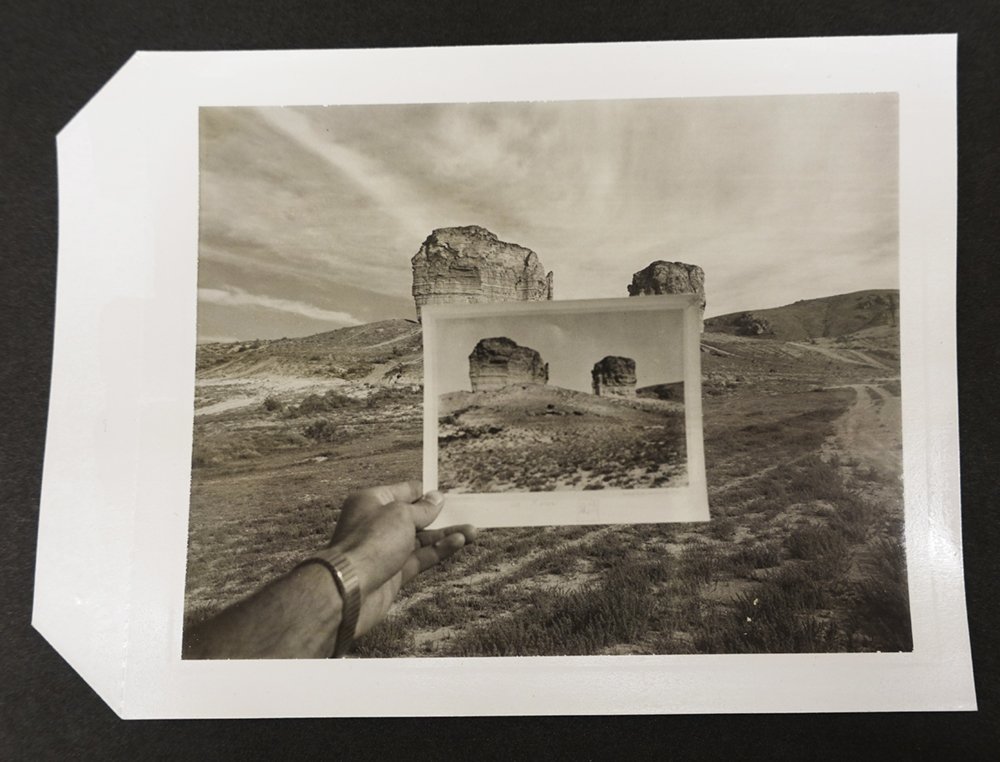
Copy print and Polaroid print used for measurement, Echo Canyon, Utah

Timothy O'Sullivan, Green River Buttes, Green River, WY, 1872

Mark Klett and Gordon Bushaw for Rephotographic Surgery Project, Castle Rock, Green River, WY, 1979

William Henry Jackson, Hot Springs and the Castle Geyser, 1872

Mark Klett and Gordon Bush for the Rephotographic Survey Project, Crested Hot Springs and the Castle Geyser, Yellowstone National Park, WY, 1978

William Henry Jackson, Devil's Slide, Weber Canyon, UT, ca. 1880

Mark Klett for the Rephotographic Survey Project, Devil's Slide, Weber Canyon, UT, 1978

Timothy O'Sullivan, Cañon de Chile, walls of the Grand Cañon, about 1,200 feet in height, 1873

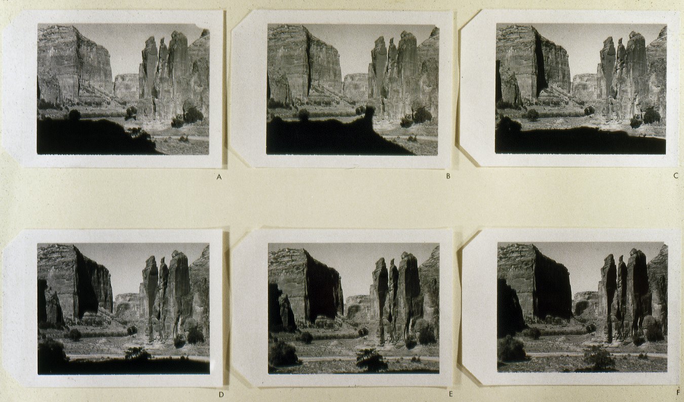
Mark Klett for the Rephotographic Survey Project, Monument Rock, Canyon de Chelly National Monument, AZ, 1978

William Henry Jackson, Mountain of the Holy Cross in the Great National Range, CO, 1873

Mark Klett and Gordon Bush for the Rephotographic Survey Project, Mountain of the Holy Cross, CO, 1978

Timothy O'Sullivan, Steamboat Springs, Wash Valley, NV, 1868

Mark Klett for the Rephotographic Survey Project, Steamboat Springs, NV, 1979

William Henry Jackson, Moraines on Clear Creek, Valley of the Arkansas, CO, 1873

Mark Klett and JoAnn Verburg for the Rephotographic Survey Project, Clear Creek Reservoir, CO, 1977

Timothy O'Sullivan, Green River Cañon, Upper Cañon, Great Bend, Uinta Mountains, The Horseshoe and Green River below the bend from Flaming Gorge Ridge, 1872

Mark Klett for the Rephotographic Survey Project, Flaming Gorge Reservoir from above the site of the Great Bend, UT, 1978

Timothy O'Sullivan, Shoshone Falls, view across top of the falls, Snake River, ID, 1874
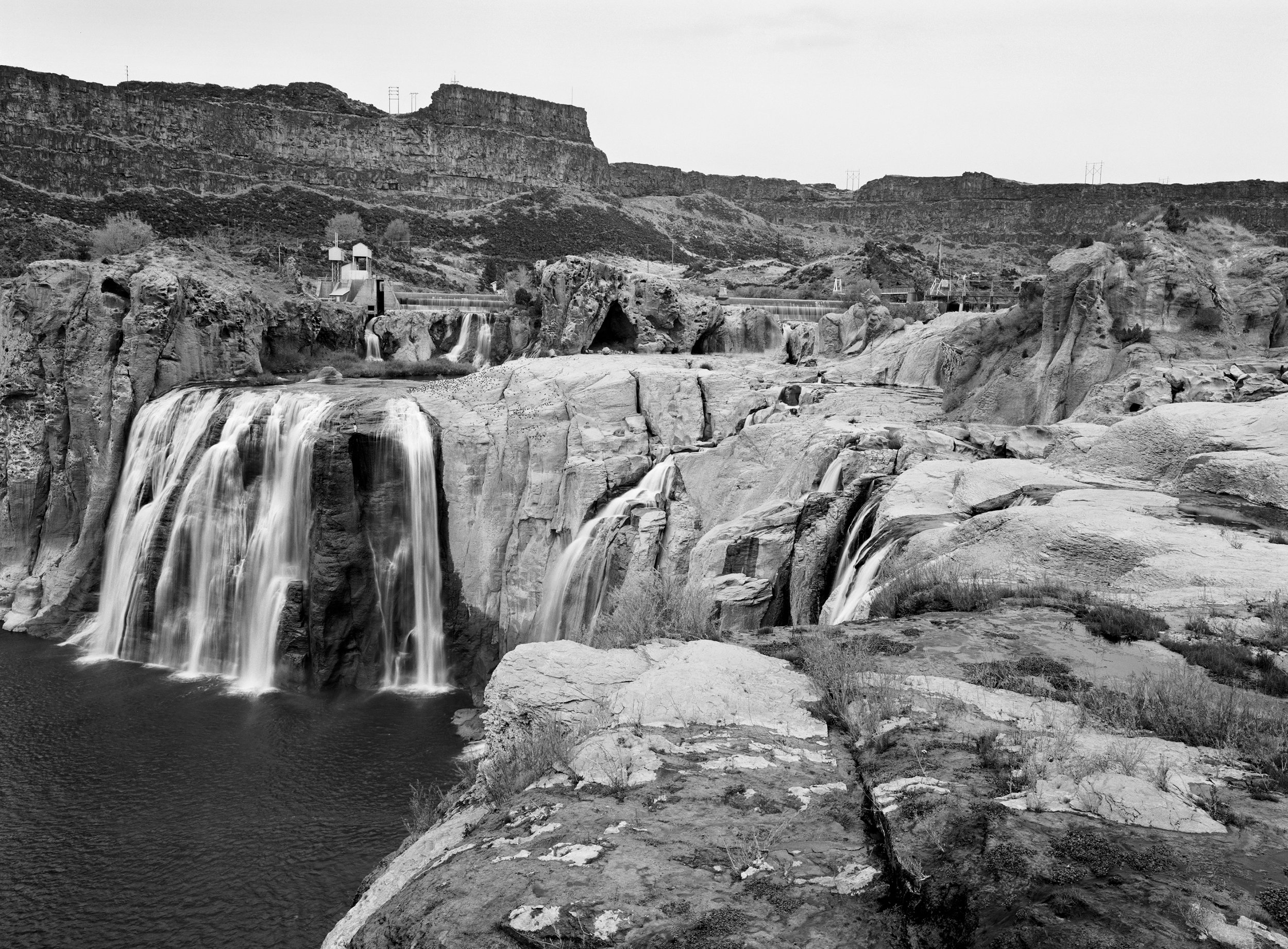
Mark Klett for the Rephotographic Survey Project, Shoshone Falls, restricted water flow, Twin Rivers, ID, 1980

Timothy O'Sullivan, Quartz Mill near Virginia City, 1868

Mark Klett for the Resphotographic Survey Project, Site of the Gould and Curry Mine, Virginia City, NV, 1979

William Henry Jackson, Gateway of the Garden of the Gods, Colorado, 1873

Mark Klett and JoAnn Verburg for the Rephotographic Survey Project, Gateway of the Garden of the Gods, Colorado Springs, CO, 1977

Timothy O'Sullivan, Tertiary Bluffs near Green River City, WY, 1872

Mark Klett for the Rephotographic Survey Project, Teapot Rock and Sugar Bowl, Green River, WY, 1979

Timothy O'Sullivan, Vermillion Creek Cañon looking downstream, 1872

Mark Klett for the Rephotographic Survey Project, Vermillion Creek Canyon, CO, 1979

Timothy O'Sullivan, Historic Spanish record of the Conquest, south side of Inscription Rock, NM, 1873

Mark Klett for the Rephotographic Survey Project, Spanish Inscription, Inscription Rock, El Morro National Monument, NM, 1978

William Henry Jackson, 1875. Georgetown Colorado (United State Geological Survey)

Gordon Bushaw for the Rephotographic Survey Project, 1978. Georgetown Colorado.
1977-1979
Fieldwork Slides
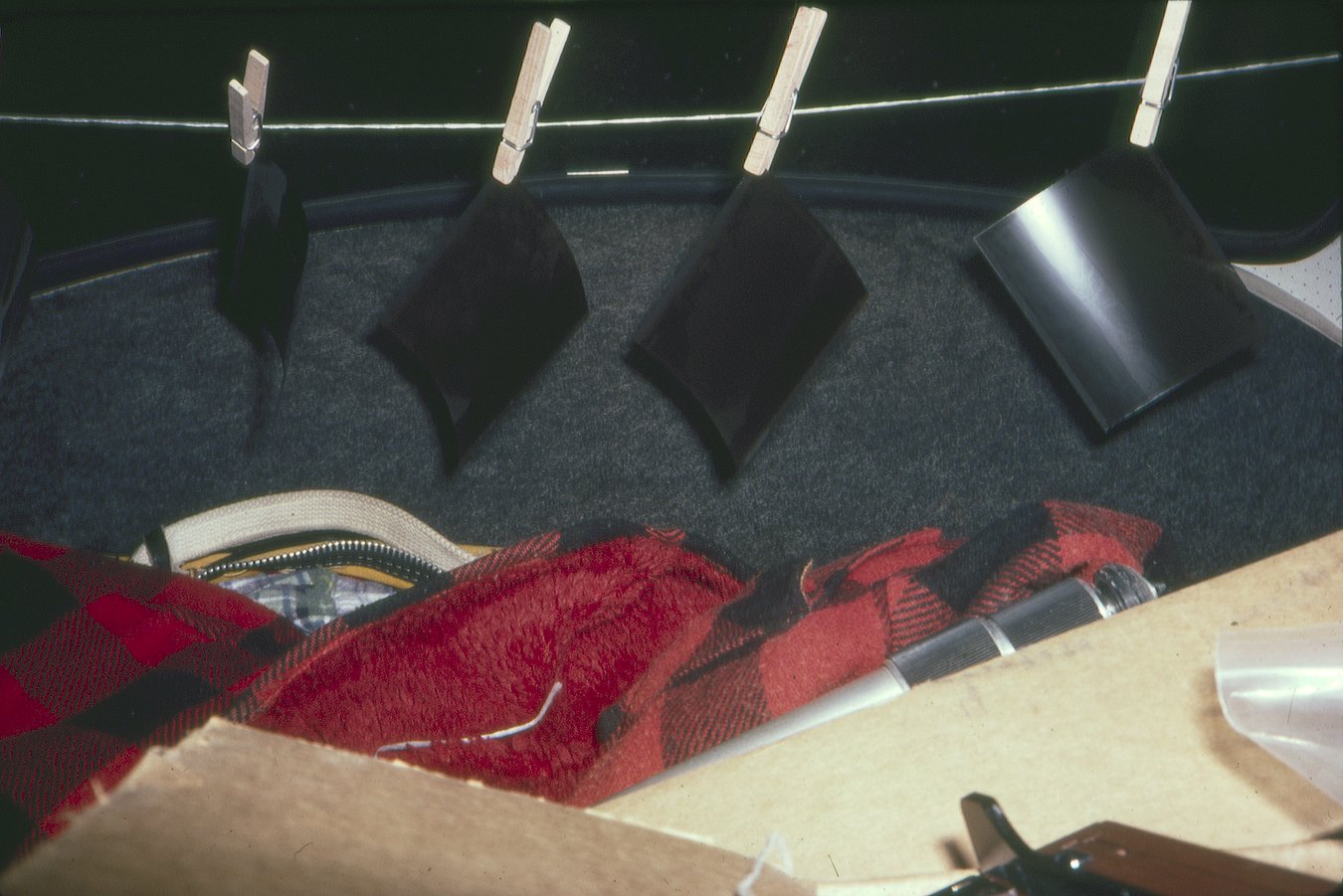
Drying Polaroid negatives in the back of Volkswagon Beatle.

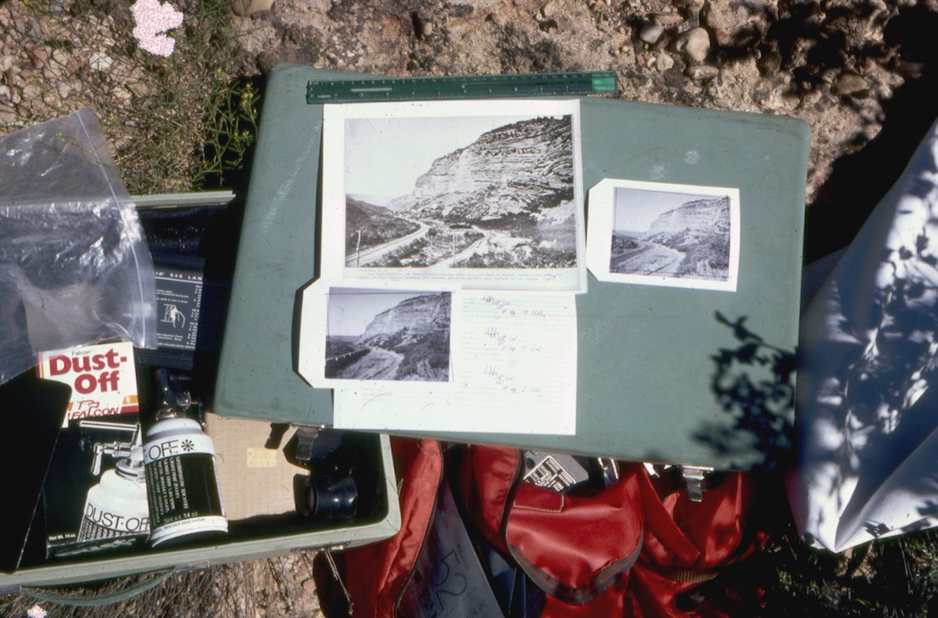
Envelope recording site data for 4x5 negatives.

Cars driving the gateway to the Garden of the Gods, Colorado, 1977.
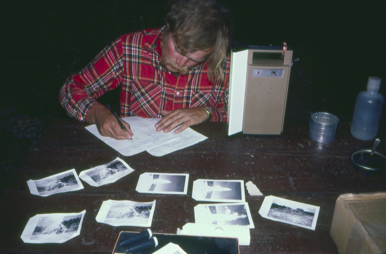
Gordy Bushaw filling out site data forms at camp in Yellowstone, Wyoming, 1978.

Gordy Bushaw and Doug Munson at the site of O'Sullivan's Castle Rock, Green River, Wyoming, 1979.

JoAnn Verburg and workshops students propping up Mark to match Jackson's vantage point at Garden of the Gods, Colorado, 1977.

Last site of 1979, Vermillion Creek Canyon, Colorado.
Polaroid photographs documenting changing light at Monument Rock, Canyon De Chelly, 1978.

Road passing the Great Eastern, Echo Canyon, Utah, 1978.
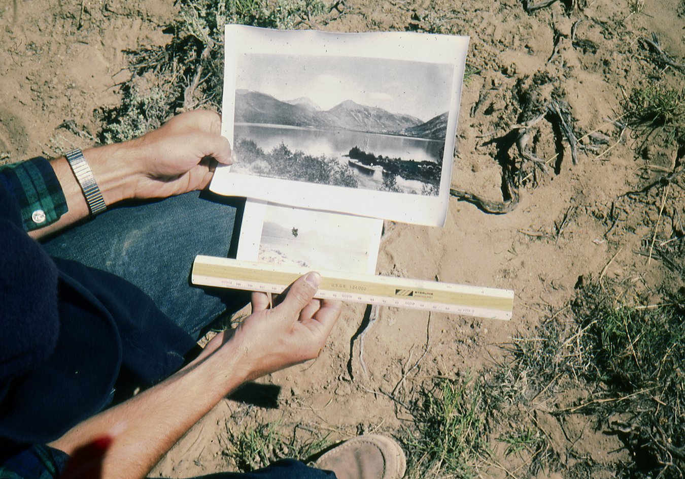
Measuring Prints, Twin Lakes, Colorado, 1977.

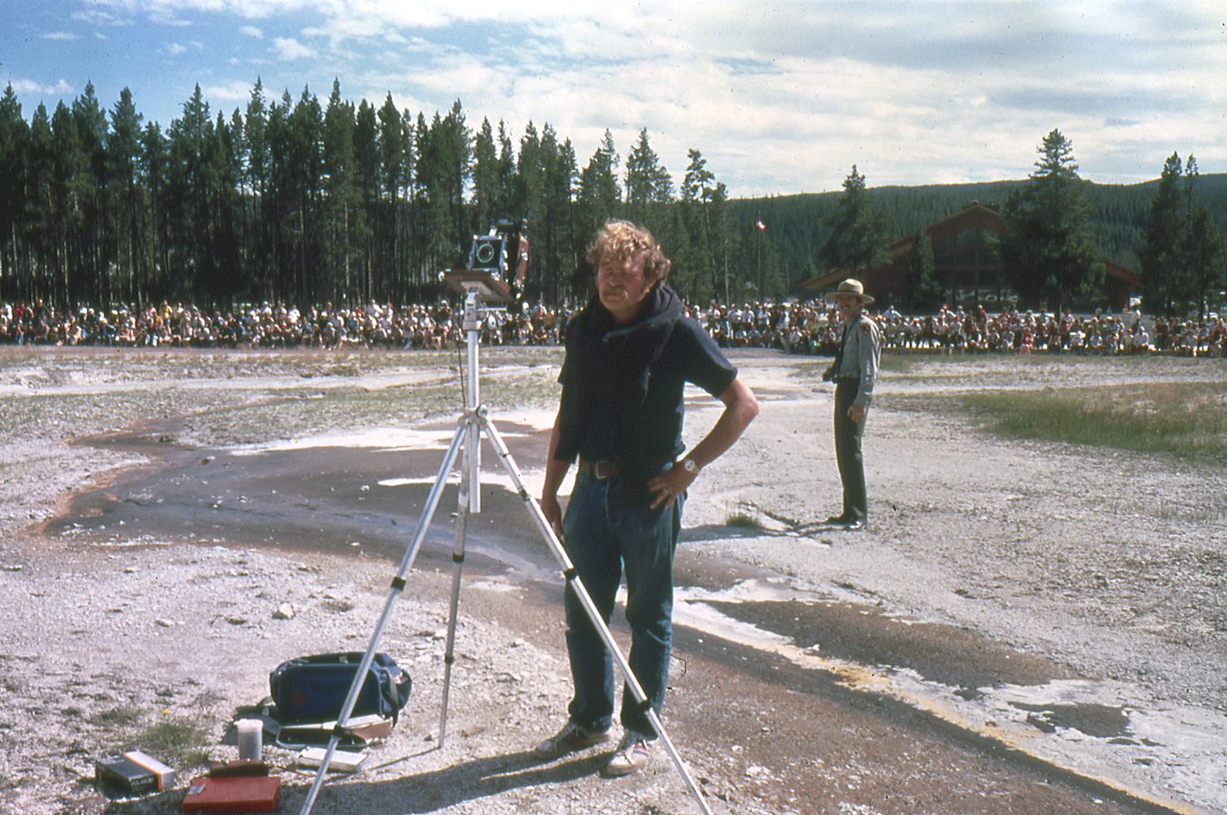
Mark and ranger with 3000 people waiting for Old Faithful to erupt, Yellowstone, Wyoming, 1978.

Waiting for the light, photographing Mountain of the Holy Cross from Notch Mountain, Colorado, 1978.
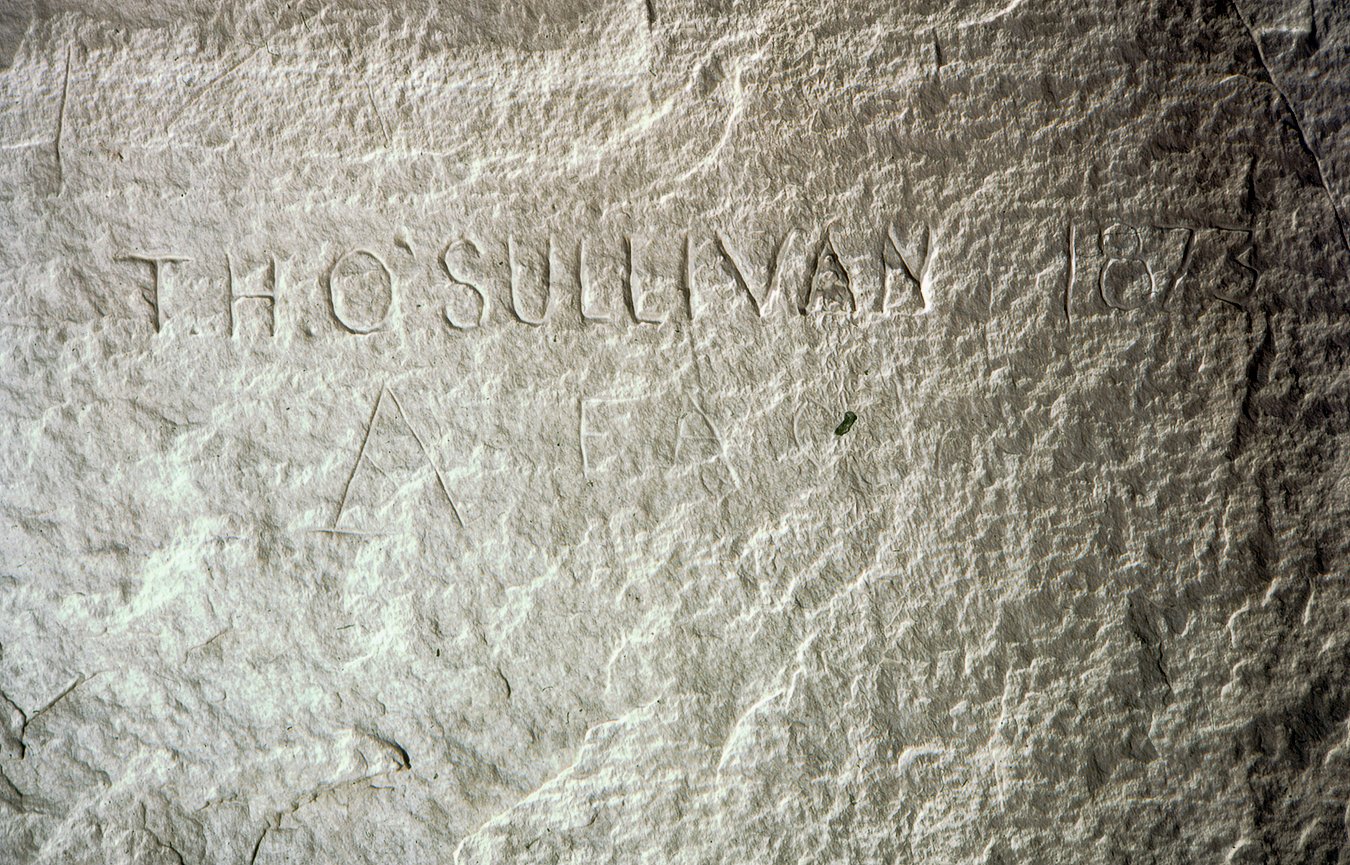
Where Timothy O'Sullivan carved his name in Inscription Rock, El Morro, New Mexico, 1973.
Gordy Bushaw and Ranger waiting for Old Faithful to erupt, Yellowstone, Wyoming, 1978.

4x5 camera elevated above tufa knob where Timothy O'Sullivan placed his larger camera to photograph Pyramid Isle, Pyramid Lake, Nevada, 1979.

Inside the ruins of Mummy Cave, Canyon del Muerto, Arizona, 1978.
Checking the location of O'Sullivan's Teapot Rock, Green River, Wyoming, 1978.
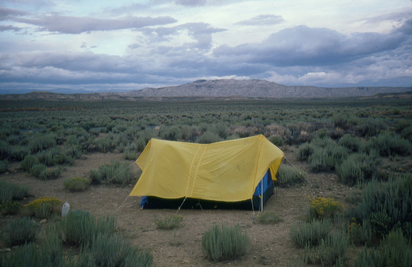
Camp in Southeast Wyoming, 1979.

Tools of the trade

Related:
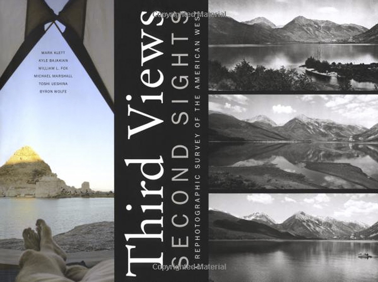
Third Views, Second Sights, A Rephotographic Survey of the American West
Museum of New Mexico Press, Santa Fe, 2004

Second View: The Rephotographic Survey Project, with Ellen Manchester and JoAnn Verburg
University of New Mexico Press, 1984

Seeing Time: Forty Years of Photographs
University of Texas Press, 2020